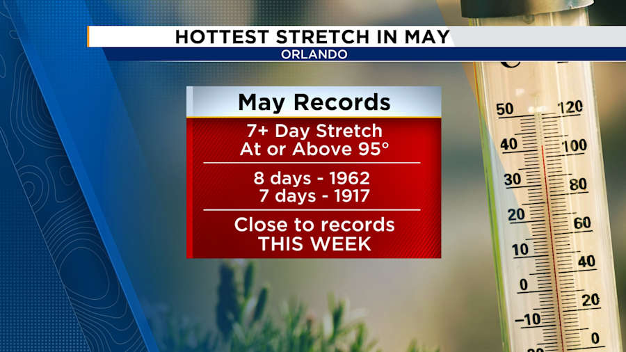
ORLANDO, Fla. – Get ready Central Florida, we’re about to experience the hottest stretch of May weather we’ve seen in more than 60 years.
To put that in perspective, in recorded history, Central Florida has only had two full weeks of 95-plus-degree days in May.
This kind of heat is not normal for this time of year, and it’s coming in fast.
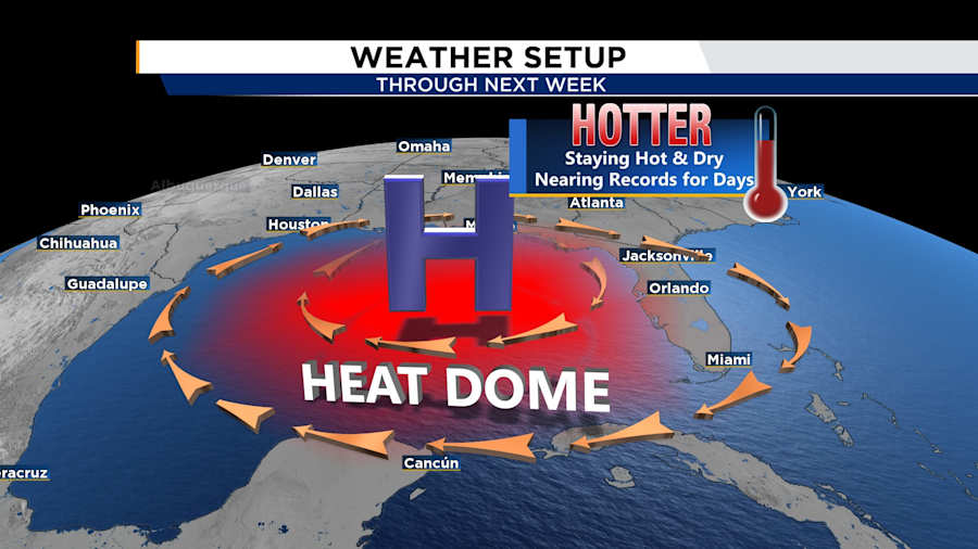
Weather setup
A big ridge of high pressure sitting over the Gulf is pushing hotter, drier air across Florida.
Think of it like a giant heat dome that is trapping warmth over us and keeping rain and clouds away.
There is no relief in sight, even at the coast.
Friday
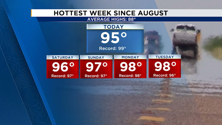
Most of the area will hit the mid-90s through the afternoon.
Daytona Beach could flirt with its record high of 94 degrees.
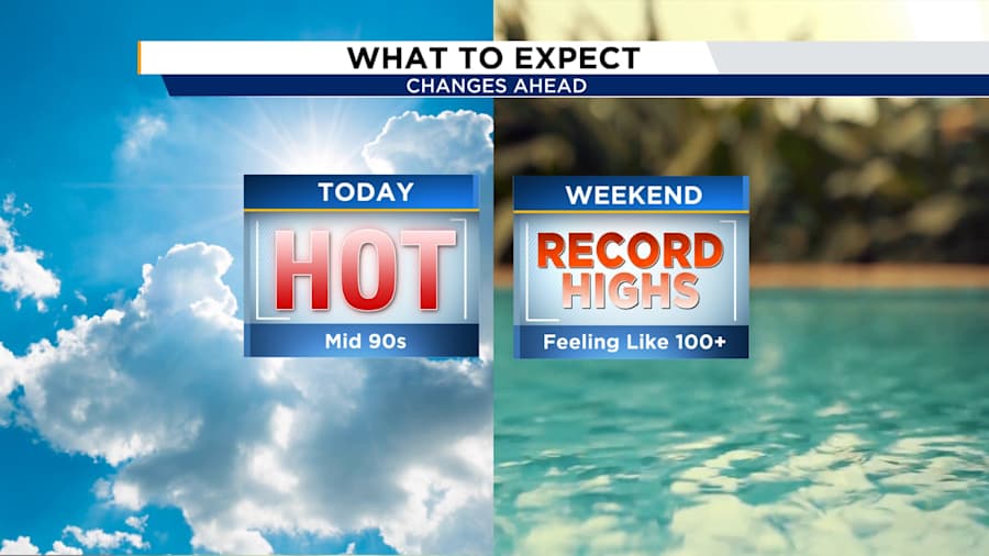
With the added humidity factored in, the “feels-like” temperature will be near 100 degrees.
Weekend
Looking ahead from Saturday through midweek, we stay locked in the heat wave.
Temperatures will hit the mid- to upper 90s, nearing records for several days.
Coastal communities won’t be able to escape from the heat either, as the east coast sea breeze won’t arrive until later in the day.
What will it feel like?
The heat index will run from 100 to 105 for several days in a row.
This means we will be experiencing summer-level heat, about a month early.
Due to the rarity of this heat wave, it will take some time to get our bodies acclimated.
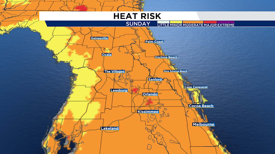
From Sunday through Tuesday, many areas in Central Florida could see moderate to major heat stress risk levels.
How to stay safe:
-
Hydrate constantly — don’t wait until you’re thirsty.
-
Take breaks in the shade or in air-conditioned areas, especially in the afternoon.
-
Check on neighbors, kids, pets and anyone without reliable AC.
-
Don’t leave people or pets in parked cars.
Any relief in sight?
A slight break may come late next week, when a weak front sneaks in bringing a small chance (20–30%) of showers.
If that front moves in quicker, we might bump up those rain chances a little earlier.
After that, we could finally get back to more seasonable temps in the 80s, especially with a return to breezy onshore winds.